It’s a feeling we all dread. A major storm passes, the winds die down, and you’re left wondering, "What happens now?" The uncertainty can be overwhelming. For years, the immediate aftermath of a hurricane was a black box. We had to wait for first responders, for roads to be cleared, for adjusters to finally get on the ground.
But that’s starting to change. Dramatically.
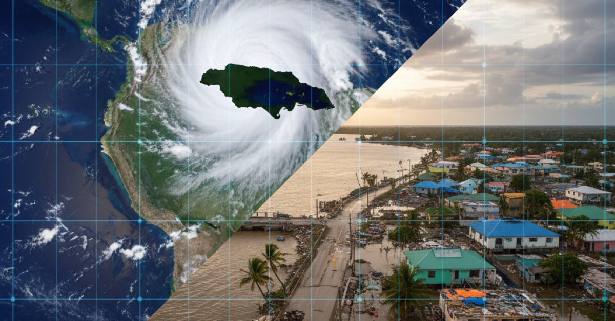
As Hurricane Melissa recently churned past Bermuda, a different kind of story was unfolding hundreds of miles away in Jamaica. And we weren't learning about it from reporters on the ground, but from eyes in the sky. New satellite data has given us a stunningly clear, and heartbreaking, look at the devastation in tourist hotspots like Montego Bay and across the western part of the country.
A Bird's-Eye View of the Damage
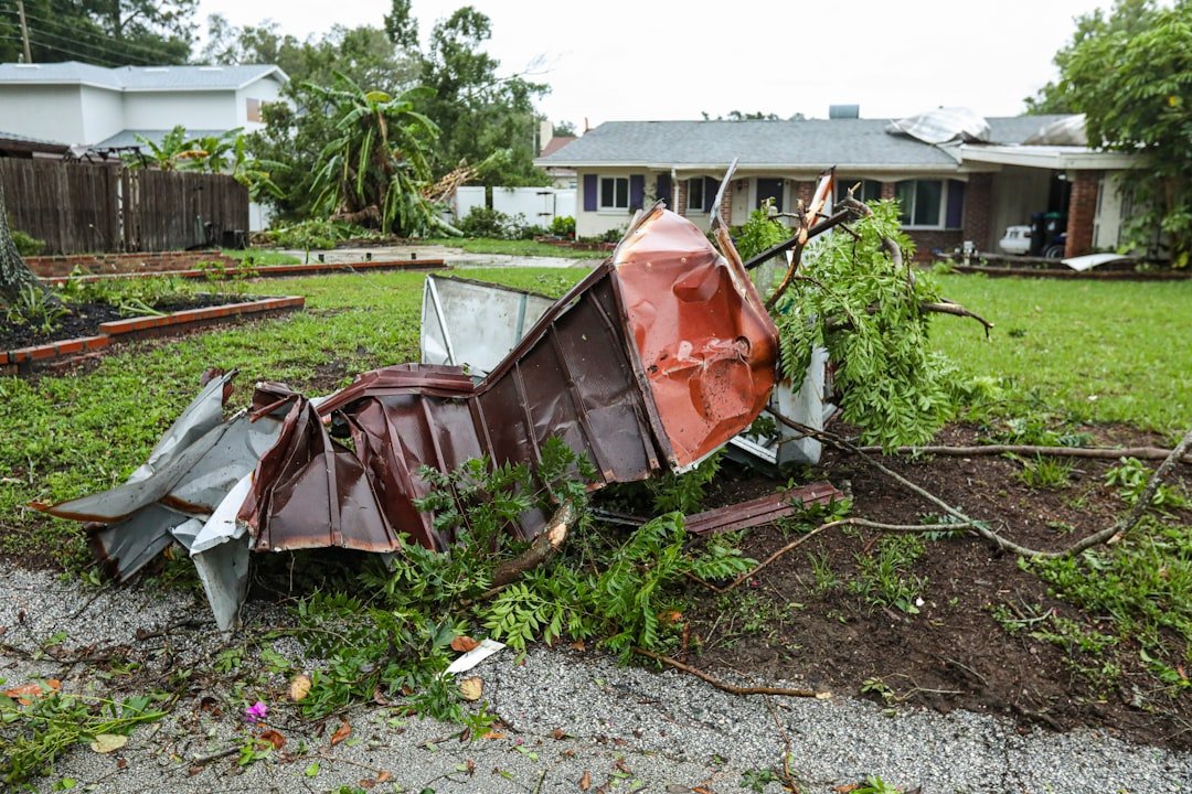
Let's be honest, the numbers are staggering. The initial data shows that in the hardest-hit areas, at least 40% of buildings and roads have been damaged or destroyed. Think about that for a second. Nearly half of a community's infrastructure, gone in a matter of hours.
In the past, getting a number like that would have taken weeks, maybe even months, of painstaking, on-the-ground assessments. It would have been a slow, frustrating process for everyone involved, especially for the families and business owners desperate to start rebuilding.
Today, we have this critical information almost instantly. It’s a total shift in how we see and respond to natural disasters. But what does this high-tech view from space actually mean for you and your insurance claim?
So, How Does This Actually Help You Get Back on Your Feet?
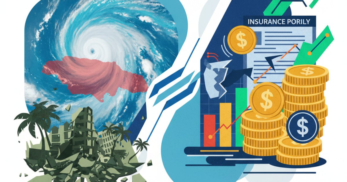
This isn't just cool technology for the sake of it. This has a massive, real-world impact on the insurance process, and it’s almost all good news for policyholders.
Faster Claims, Faster Payouts
Imagine this: your neighborhood is inaccessible due to flooding and debris. In the old days, you’d file a claim and then… you’d wait. You’d be in a queue with thousands of other people, waiting for an adjuster to be assigned, and then waiting for them to physically get to your property.
With high-resolution satellite imagery, your insurance company can see the "before" and "after" of your home without ever setting foot on your street. They can see that your roof is gone or that your entire block is underwater.
This allows them to do a few incredible things:
- Triage claims: They can immediately identify the most catastrophic losses and prioritize them.
- Pre-approve payments: For many, they can verify the damage is severe enough to cut a check for initial expenses (like temporary housing and food) long before an adjuster shows up.
- Deploy resources effectively: They know exactly where the worst damage is, so they can send their mobile response teams to the right places first.
It’s the difference between waiting for news to travel by horse and getting an instant text message. It radically speeds up the first, most critical phase of your recovery.
A Clearer, Unbiased Picture
Satellite data provides an objective truth. It’s not a matter of opinion; it’s a factual record of what happened. This helps in a couple of key ways.
First, it helps verify the extent of the damage, which can simplify the claims process. Second, it helps combat fraud. Unfortunately, after every major disaster, fraudulent claims pop up, and they slow the process down for everyone and can even drive up premiums in the long run. Having an undeniable photographic record helps ensure that claims are legitimate, which is better for all policyholders.
This is Leading to a Whole New Kind of Insurance
This technology is so powerful that it’s paving the way for a new type of insurance that I think we’ll be seeing a lot more of: parametric insurance.
It sounds complicated, but the idea is actually incredibly simple.
Think of it like a bet. Instead of paying you based on the cost to repair your specific damage (which requires a long adjustment process), a parametric policy pays you a pre-agreed amount if a specific event happens.
That event, or "trigger," could be:
- A Category 4 hurricane making landfall within 20 miles of your home.
- An earthquake of a certain magnitude being recorded.
- Or, thanks to our eyes in the sky, satellite data confirming that 30% of the buildings in your zip code have been destroyed.
Once the trigger is met—boom. The payout is automatic and almost instant. No adjusters, no haggling, no waiting. The data proves the event happened, so the policy pays. For the damage in Jamaica, a parametric policy could have put money in people's hands within days, not months.
While we're not at a point where this will replace your standard homeowner's policy, it’s becoming an amazing tool for businesses and even entire communities to get immediate cash flow for recovery right after a disaster.
It's All About a Faster, More Human Recovery
When you're dealing with the aftermath of a storm like Melissa, the last thing you need is more uncertainty and delay. What this new satellite technology really offers is a bit more certainty in a chaotic time.
It’s a powerful reminder that while technology can seem cold and distant, its best use is often deeply human. It’s about getting a family into a safe hotel faster. It’s about helping a small business owner buy new inventory sooner. Ultimately, it’s about using a view from 400 miles up to help people on the ground get back to their lives. The view may be from space, but the impact is felt right here at home.